
Thank you for supporting this site ❤️
Make a donation
Make a donation
Gear up for your next adventure:
As an Amazon Associate, this site earns from qualifying purchases at no extra cost to you.
Colli a Volturno topographic map
Click on the map to display elevation.
Thank you for supporting this site ❤️
Make a donation
Make a donation
Gear up for your next adventure:
As an Amazon Associate, this site earns from qualifying purchases at no extra cost to you.
About this map
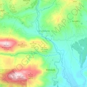
Name: Colli a Volturno topographic map, elevation, terrain.
Location: Colli a Volturno, Isernia, Molise, 86073, Italy (41.55257 14.06041 41.62415 14.15155)
Average elevation: 1,601 ft
Minimum elevation: 771 ft
Maximum elevation: 3,363 ft
Thank you for supporting this site ❤️
Make a donation
Make a donation
Gear up for your next adventure:
As an Amazon Associate, this site earns from qualifying purchases at no extra cost to you.