
Thank you for supporting this site ❤️
Make a donation
Make a donation
Gear up for your next adventure:
As an Amazon Associate, this site earns from qualifying purchases at no extra cost to you.
Líjar topographic map
Click on the map to display elevation.
Thank you for supporting this site ❤️
Make a donation
Make a donation
Gear up for your next adventure:
As an Amazon Associate, this site earns from qualifying purchases at no extra cost to you.
About this map
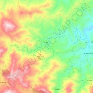
Name: Líjar topographic map, elevation, terrain.
Location: Líjar, Valle del Almanzora, Almeria, Andalusia, 04859, Spain (37.26187 -2.27064 37.32148 -2.18863)
Average elevation: 2,241 ft
Minimum elevation: 1,355 ft
Maximum elevation: 3,360 ft
Thank you for supporting this site ❤️
Make a donation
Make a donation
Gear up for your next adventure:
As an Amazon Associate, this site earns from qualifying purchases at no extra cost to you.