
Campo do Gerês topographic map
Interactive map
Click on the map to display elevation.
About this map
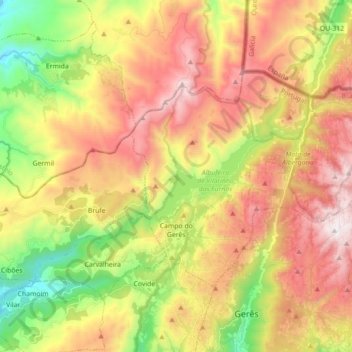
Name: Campo do Gerês topographic map, elevation, terrain.
Location: Campo do Gerês, Terras de Bouro, Braga, 4840-030, Portugal (41.73723 -8.22169 41.82063 -8.04473)
Average elevation: 2,493 ft
Minimum elevation: 364 ft
Maximum elevation: 4,665 ft
Other topographic maps
Click on a map to view its topography, its elevation and its terrain.
Vilar da Veiga
Portugal > Braga > Terras de Bouro
Vilar da Veiga, Terras de Bouro, Braga, Portugal
Average elevation: 2,300 ft