
Scandinavia topographic map
Interactive map
Click on the map to display elevation.
About this map
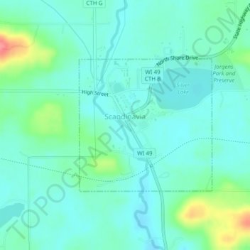
Name: Scandinavia topographic map, elevation, terrain.
Location: Scandinavia, Waupaca County, Wisconsin, United States (44.45354 -89.15624 44.46784 -89.13611)
Average elevation: 961 ft
Minimum elevation: 906 ft
Maximum elevation: 1,158 ft
Waupaca County trails, hiking, mountain biking, running and outdoor activities
Other topographic maps
Click on a map to view its topography, its elevation and its terrain.