
Hawarden topographic map
Interactive map
Click on the map to display elevation.
About this map
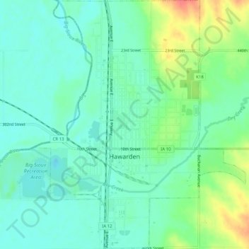
Name: Hawarden topographic map, elevation, terrain.
Location: Hawarden, Sioux County, Iowa, United States (42.98198 -96.50035 43.01867 -96.46095)
Average elevation: 1,198 ft
Minimum elevation: 1,142 ft
Maximum elevation: 1,332 ft
Other topographic maps
Click on a map to view its topography, its elevation and its terrain.
Sioux County
United States > Iowa > Sioux County
Sioux County, Iowa, United States
Average elevation: 1,371 ft
Chatsworth
United States > Iowa > Sioux County > Chatsworth > Chatsworth
Chatsworth, Sioux County, Iowa, 51011, United States
Average elevation: 1,178 ft
Chatsworth
United States > Iowa > Sioux County
Chatsworth, Sioux County, Iowa, 51011, United States
Average elevation: 1,171 ft