
Rebaix topographic map
Interactive map
Click on the map to display elevation.
About this map
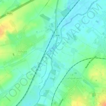
Name: Rebaix topographic map, elevation, terrain.
Location: Rebaix, Ath, Hainaut, Wallonie, Belgique (50.65958 3.79584 50.65997 3.79613)
Average elevation: 108 ft
Minimum elevation: 69 ft
Maximum elevation: 197 ft
Other topographic maps
Click on a map to view its topography, its elevation and its terrain.