
Eatontown topographic map
Interactive map
Click on the map to display elevation.
About this map
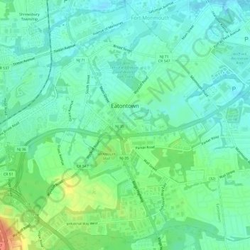
Name: Eatontown topographic map, elevation, terrain.
Location: Eatontown, Monmouth County, New Jersey, United States (40.27066 -74.08062 40.31499 -74.02762)
Average elevation: 46 ft
Minimum elevation: -3 ft
Maximum elevation: 154 ft
Monmouth County trails, hiking, mountain biking, running and outdoor activities
Other topographic maps
Click on a map to view its topography, its elevation and its terrain.
Navesink
United States > New Jersey > Monmouth County > Middletown Township > Navesink
Average elevation: 89 ft
Sommers Boy Scout Park
United States > New Jersey > Monmouth County > Oceanport > Sands Point
Average elevation: 7 ft
North Middletown
United States > New Jersey > Monmouth County > Middletown Township
Average elevation: 13 ft
Stone Tavern
United States > New Jersey > Monmouth County > Upper Freehold Township
Average elevation: 203 ft
Chapel Hill
United States > New Jersey > Monmouth County > Middletown Township
Average elevation: 89 ft
Mount Pleasant
United States > New Jersey > Monmouth County > Marlboro Township
Average elevation: 190 ft
Lafayette Mills
United States > New Jersey > Monmouth County > Manalapan Township
Average elevation: 118 ft
Ellisdale
United States > New Jersey > Monmouth County > Upper Freehold Township
Average elevation: 112 ft
Clarksburg
United States > New Jersey > Monmouth County > Millstone Township
Average elevation: 217 ft
Hillsdale
United States > New Jersey > Monmouth County > Colts Neck Township
Average elevation: 154 ft
Freewood Acres
United States > New Jersey > Monmouth County > Howell Township
Average elevation: 121 ft
Stonehurst West
United States > New Jersey > Monmouth County > Freehold Township
Average elevation: 151 ft
Morganville
United States > New Jersey > Monmouth County > Marlboro Township
Average elevation: 141 ft
Glendola
United States > New Jersey > Monmouth County > Wall Township > Glendola
Average elevation: 72 ft
Freehold
United States > New Jersey > Monmouth County > Freehold Borough > Freehold
Freehold has an elevation of 174 feet (53 m) above sea level at its center.
Average elevation: 148 ft
Robinsville
United States > New Jersey > Monmouth County > Upper Freehold Township
Average elevation: 184 ft
Fort Hancock
United States > New Jersey > Monmouth County > Middletown Township
Average elevation: 0 ft
Sandy Hook Lighthouse
United States > New Jersey > Monmouth County > Fort Hancock
Average elevation: 3 ft