
Laurenti topographic map
Interactive map
Click on the map to display elevation.
About this map
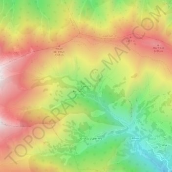
Name: Laurenti topographic map, elevation, terrain.
Location: Laurenti, Elva, Coni, Piémont, Italie (44.53623 7.03705 44.57623 7.07705)
Average elevation: 6,604 ft
Minimum elevation: 4,311 ft
Maximum elevation: 8,848 ft
Other topographic maps
Click on a map to view its topography, its elevation and its terrain.
Chiosso Superiore
Italie > Piémont > Coni > Elva
Chiosso Superiore, Elva, Coni, Piémont, Italie
Average elevation: 6,375 ft
Colle di Sampeyre
Italie > Piémont > Coni > Elva
Colle di Sampeyre, Strada Sampeyre - Colle Sampeyre, Elva, Coni, Piémont, Italie
Average elevation: 6,811 ft