
Thank you for supporting this site ❤️
Make a donation
Make a donation
Gear up for your next adventure:
As an Amazon Associate, this site earns from qualifying purchases at no extra cost to you.
Dahmouni topographic map
Click on the map to display elevation.
Thank you for supporting this site ❤️
Make a donation
Make a donation
Gear up for your next adventure:
As an Amazon Associate, this site earns from qualifying purchases at no extra cost to you.
About this map
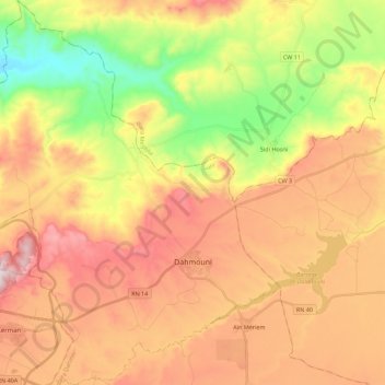
Name: Dahmouni topographic map, elevation, terrain.
Location: Dahmouni, Dahmouni District, Tiaret, Algeria (35.35862 1.33268 35.54046 1.52476)
Average elevation: 2,913 ft
Minimum elevation: 1,886 ft
Maximum elevation: 3,888 ft
Thank you for supporting this site ❤️
Make a donation
Make a donation
Gear up for your next adventure:
As an Amazon Associate, this site earns from qualifying purchases at no extra cost to you.