Geolocate

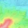
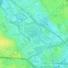
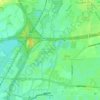
Islington topographic map

Click on the map to display elevation.

About this map

Name: Islington topographic map, elevation, terrain.

Location: Islington, London, Greater London, England, N1 2SJ, United Kingdom (51.49843 -0.13991 51.57843 -0.05991)

Average elevation: 98 ft

Minimum elevation: -3 ft

Maximum elevation: 430 ft

Other topographic maps

Click on a map to view its topography, its elevation and its terrain.
London

United Kingdom > England > London

Average elevation: 253 ft

Plumstead Common

United Kingdom > England > London

Average elevation: 144 ft

Hampstead Heath

United Kingdom > England > London

Average elevation: 308 ft

Hackney Marshes

United Kingdom > England > London

Average elevation: 33 ft

Pool River

United Kingdom > England > London

Average elevation: 118 ft

London

United Kingdom > England > London

Average elevation: 69 ft

Soho Square

United Kingdom > England > London > Islington

Average elevation: 92 ft

Kensington Gardens

United Kingdom > England > London

Average elevation: 82 ft

Hampstead No. 1 Pond

United Kingdom > England > London

Average elevation: 266 ft

Harmondsworth Moor

United Kingdom > England > London

Average elevation: 85 ft

Gear up for your next adventure:

🪶Multi‑Purpose Knife - Useful blade for camp and trail
🚑Emergency Bivvies - Heat-reflective sleeping bags for survival situations
👟Trail Running Shoes - Lightweight shoes for trail runners
🥘Titanium Cookware - Durable, featherlight pots and pans for backpacking
📷Action Camera - Capture your outdoor adventures in HD

As an Amazon Associate, this site earns from qualifying purchases at no extra cost to you.