Geolocate

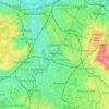
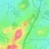
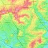
Pool River topographic map

Click on the map to display elevation.

About this map

Name: Pool River topographic map, elevation, terrain.

Location: Pool River, Perry Vale, London Borough of Bromley, London, Greater London, England, SE26 5FT, United Kingdom, Pool River (51.41467 -0.03980 51.42549 -0.03018)

Average elevation: 118 ft

Minimum elevation: 66 ft

Maximum elevation: 197 ft

Other topographic maps

Click on a map to view its topography, its elevation and its terrain.
London

United Kingdom > England > London

Average elevation: 253 ft

London

United Kingdom > England > London

Average elevation: 138 ft

Stratford

United Kingdom > England > London

Average elevation: 36 ft

Islington

United Kingdom > England > London

Average elevation: 98 ft

Tooting

United Kingdom > England > London

Average elevation: 98 ft

London

United Kingdom > England > London

Average elevation: 69 ft

Twickenham

United Kingdom > England > London

Average elevation: 59 ft

One Tree Close

United Kingdom > England > London

Average elevation: 141 ft

Erith

United Kingdom > England > London

Average elevation: 56 ft

Gould's Green

United Kingdom > England > London

Average elevation: 125 ft

Malden Rushett

United Kingdom > England > London > Malden Rushett

Average elevation: 174 ft

Gear up for your next adventure:

🔋Solar Power Banks - Keep your GPS and phone charged in remote wilderness areas
📻Weather Alert Radios - Stay informed of storm risks while off-the-grid
🥾Men's Hiking Boots - Durable, waterproof footwear for rugged terrain and steep inclines
🏥Hiking First Aid Kits - Comprehensive medical kits for remote trail injuries
🛰️Handheld GPS Units - Professional satellite navigators for precise backcountry mapping

As an Amazon Associate, this site earns from qualifying purchases at no extra cost to you.