
Tayoltita topographic map
Interactive map
Click on the map to display elevation.
About this map
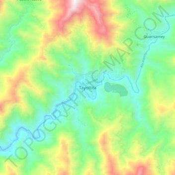
Name: Tayoltita topographic map, elevation, terrain.
Location: Tayoltita, San Dimas, Durango, México (24.06687 -105.96506 24.14687 -105.88506)
Average elevation: 3,120 ft
Minimum elevation: 1,516 ft
Maximum elevation: 6,247 ft
Other topographic maps
Click on a map to view its topography, its elevation and its terrain.
Puentecillas
Puentecillas, San Dimas, Durango, México
Average elevation: 8,455 ft