Geolocate

Arayat topographic map

Click on the map to display elevation.

About this map

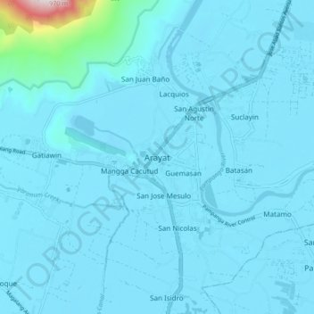
Name: Arayat topographic map, elevation, terrain.

Location: Arayat, Pampanga, Central Luzon, 2012, Philippines (15.11150 120.72956 15.19150 120.80956)

Average elevation: 131 ft

Minimum elevation: -7 ft

Maximum elevation: 2,612 ft

Gear up for your next adventure:

📷Action Camera - Capture your outdoor adventures in HD
📶Satellite Messenger - Communication device off‑grid
🦶Carbon Trekking Poles - Reduce knee impact on steep descents with ultra-light poles
GPS Sports Watch - GPS watch for running, hiking and training
💧Water Purification System - Clean water on the trail with reliable purifiers

As an Amazon Associate, this site earns from qualifying purchases at no extra cost to you.