Geolocate

Wilton topographic map

Click on the map to display elevation.

About this map

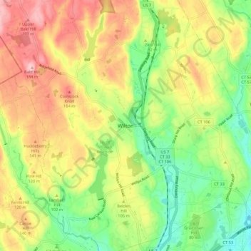
Name: Wilton topographic map, elevation, terrain.

Location: Wilton, Fairfield, Connecticut, 06897, USA (41.15537 -73.47790 41.23537 -73.39790)

Average elevation: 335 ft

Minimum elevation: 69 ft

Maximum elevation: 640 ft

Gear up for your next adventure:

🌐World Map Poster - Decorative world maps with topographic info
🗺️NatGeo Topo Maps - High-quality waterproof printed topographic maps of US Parks
🏕️Family Camping Gear - Essentials for group camping trips
🦶Hiking Gaiters - Keep debris and water out of your boots
🎒Outdoor Daypacks - Lightweight backpacks designed for carrying maps and essential gear

As an Amazon Associate, this site earns from qualifying purchases at no extra cost to you.