
Thank you for supporting this site ❤️
Make a donation
Make a donation
Gear up for your next adventure:
As an Amazon Associate, this site earns from qualifying purchases at no extra cost to you.
Bliss topographic map
Click on the map to display elevation.
Thank you for supporting this site ❤️
Make a donation
Make a donation
Gear up for your next adventure:
As an Amazon Associate, this site earns from qualifying purchases at no extra cost to you.
About this map
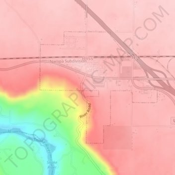
Name: Bliss topographic map, elevation, terrain.
Location: Bliss, Gooding County, Idaho, 83314, United States (42.91362 -114.95932 42.93088 -114.93457)
Average elevation: 3,156 ft
Minimum elevation: 2,661 ft
Maximum elevation: 3,304 ft
Gooding County trails, hiking, mountain biking, running and outdoor activities
Thank you for supporting this site ❤️
Make a donation
Make a donation
Gear up for your next adventure:
As an Amazon Associate, this site earns from qualifying purchases at no extra cost to you.