
Fort Cobb topographic map
Click on the map to display elevation.
About this map
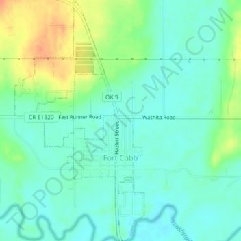
Name: Fort Cobb topographic map, elevation, terrain.
Location: Fort Cobb, Caddo County, Oklahoma, 73038, United States (35.08765 -98.45136 35.11696 -98.43209)
Average elevation: 1,280 ft
Minimum elevation: 1,234 ft
Maximum elevation: 1,375 ft