
Thank you for supporting this site ❤️
Make a donation
Make a donation
Gear up for your next adventure:
As an Amazon Associate, this site earns from qualifying purchases at no extra cost to you.
张家湾 topographic map
Click on the map to display elevation.
Thank you for supporting this site ❤️
Make a donation
Make a donation
Gear up for your next adventure:
As an Amazon Associate, this site earns from qualifying purchases at no extra cost to you.
About this map
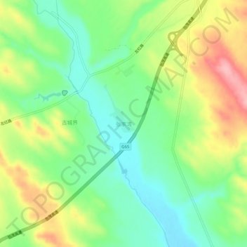
Name: 张家湾 topographic map, elevation, terrain.
Location: 张家湾, 榆林市, 陕西省, 中国 (38.10075 109.31978 38.14075 109.35978)
Average elevation: 3,655 ft
Minimum elevation: 3,474 ft
Maximum elevation: 3,924 ft
Thank you for supporting this site ❤️
Make a donation
Make a donation
Gear up for your next adventure:
As an Amazon Associate, this site earns from qualifying purchases at no extra cost to you.