
Thank you for supporting this site ❤️
Make a donation
Make a donation
Gear up for your next adventure:
As an Amazon Associate, this site earns from qualifying purchases at no extra cost to you.
Ribi topographic map
Click on the map to display elevation.
Thank you for supporting this site ❤️
Make a donation
Make a donation
Gear up for your next adventure:
As an Amazon Associate, this site earns from qualifying purchases at no extra cost to you.
About this map
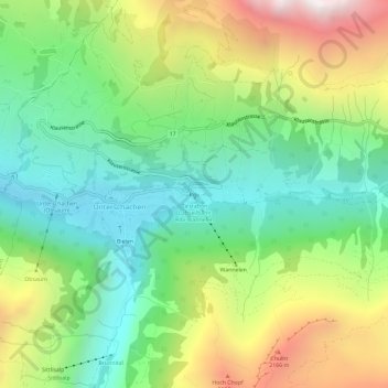
Name: Ribi topographic map, elevation, terrain.
Location: Ribi, Unterschächen, Uri, 6465, Suisse (46.84437 8.76160 46.88437 8.80160)
Average elevation: 5,066 ft
Minimum elevation: 3,176 ft
Maximum elevation: 8,337 ft
Thank you for supporting this site ❤️
Make a donation
Make a donation
Gear up for your next adventure:
As an Amazon Associate, this site earns from qualifying purchases at no extra cost to you.