
Thank you for supporting this site ❤️
Make a donation
Make a donation
Gear up for your next adventure:
As an Amazon Associate, this site earns from qualifying purchases at no extra cost to you.
Chinche topographic map
Click on the map to display elevation.
Thank you for supporting this site ❤️
Make a donation
Make a donation
Gear up for your next adventure:
As an Amazon Associate, this site earns from qualifying purchases at no extra cost to you.
About this map
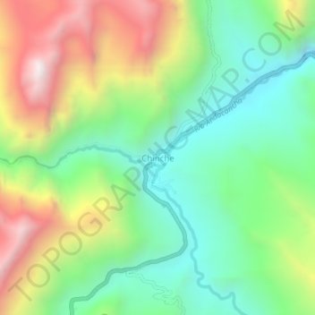
Name: Chinche topographic map, elevation, terrain.
Location: Chinche, Yanahuanca, Daniel Alcides Carrión, Pasco, Perú (-10.52770 -76.60599 -10.48770 -76.56599)
Average elevation: 12,559 ft
Minimum elevation: 11,142 ft
Maximum elevation: 14,902 ft
Thank you for supporting this site ❤️
Make a donation
Make a donation
Gear up for your next adventure:
As an Amazon Associate, this site earns from qualifying purchases at no extra cost to you.