
Thank you for supporting this site ❤️
Make a donation
Make a donation
Gear up for your next adventure:
As an Amazon Associate, this site earns from qualifying purchases at no extra cost to you.
Juns topographic map
Click on the map to display elevation.
Thank you for supporting this site ❤️
Make a donation
Make a donation
Gear up for your next adventure:
As an Amazon Associate, this site earns from qualifying purchases at no extra cost to you.
About this map
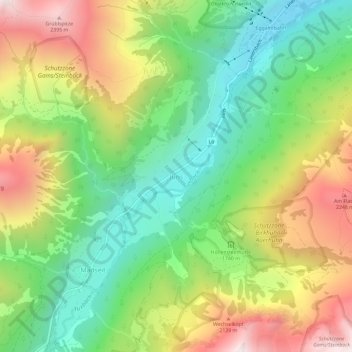
Name: Juns topographic map, elevation, terrain.
Location: Juns, Gemeinde Tux, Bezirk Schwaz, Tyrol, 6192, Austria (47.11941 11.69275 47.15941 11.73275)
Average elevation: 5,748 ft
Minimum elevation: 4,124 ft
Maximum elevation: 8,051 ft
Thank you for supporting this site ❤️
Make a donation
Make a donation
Gear up for your next adventure:
As an Amazon Associate, this site earns from qualifying purchases at no extra cost to you.