
Thank you for supporting this site ❤️
Make a donation
Make a donation
Gear up for your next adventure:
As an Amazon Associate, this site earns from qualifying purchases at no extra cost to you.
Hornuyoc topographic map
Click on the map to display elevation.
Thank you for supporting this site ❤️
Make a donation
Make a donation
Gear up for your next adventure:
As an Amazon Associate, this site earns from qualifying purchases at no extra cost to you.
About this map
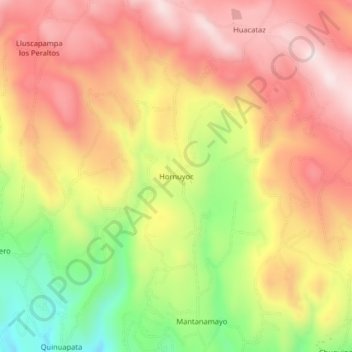
Name: Hornuyoc topographic map, elevation, terrain.
Location: Hornuyoc, Los Baños del Inca, Cajamarca, Perú (-7.10858 -78.49324 -7.06858 -78.45324)
Average elevation: 10,453 ft
Minimum elevation: 9,475 ft
Maximum elevation: 11,171 ft
Thank you for supporting this site ❤️
Make a donation
Make a donation
Gear up for your next adventure:
As an Amazon Associate, this site earns from qualifying purchases at no extra cost to you.