Geolocate

Alvie topographic map

Click on the map to display elevation.

About this map

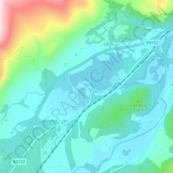
Name: Alvie topographic map, elevation, terrain.

Location: Alvie, Highland, Scotland, PH22 1QB, United Kingdom (57.14032 -3.89993 57.18032 -3.85993)

Average elevation: 935 ft

Minimum elevation: 669 ft

Maximum elevation: 2,149 ft

Gear up for your next adventure:

🪶Fire Starter Kit - Reliable fire starter for survival and camping
🥩Freeze-Dried Meals - Nutritious and lightweight food for remote expeditions
🚪Portable Camp Chair - Foldable chair for comfort at camp
👖Convertible Hiking Pants - Versatile zip-off pants for changing altitudes and temperatures
🛰️Handheld GPS Units - Professional satellite navigators for precise backcountry mapping

As an Amazon Associate, this site earns from qualifying purchases at no extra cost to you.