Geolocate

Smart Village topographic map

Click on the map to display elevation.

About this map

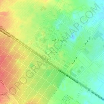
Name: Smart Village topographic map, elevation, terrain.

Location: Smart Village, Giza, 12577, Egypt (30.05194 30.99853 30.09194 31.03853)

Average elevation: 256 ft

Minimum elevation: 151 ft

Maximum elevation: 374 ft

Gear up for your next adventure:

🎒Hydration Pack - Hands‑free water reservoir for long hikes
Backpacking Tent - Lightweight and durable tent for multi‑day hikes
☀️Outdoor Sunscreen - High protection sunscreen for outdoor activities
🔋Solar Power Banks - Keep your GPS and phone charged in remote wilderness areas
🌲Outdoor Survival Books - Best books on survival skills

As an Amazon Associate, this site earns from qualifying purchases at no extra cost to you.