Geolocate

Mawsynram topographic map

Click on the map to display elevation.

About this map

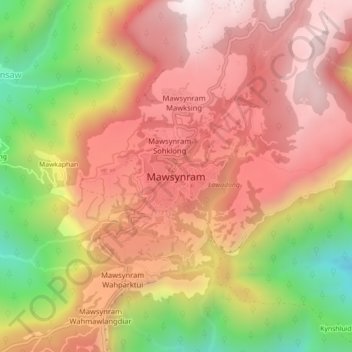
Name: Mawsynram topographic map, elevation, terrain.

Location: Mawsynram, East Khasi Hills, Meghalaya, 793113, India (25.25882 91.54245 25.33882 91.62245)

Average elevation: 3,373 ft

Minimum elevation: 505 ft

Maximum elevation: 5,755 ft

Gear up for your next adventure:

🧯Portable Fire Pit - Compact fire pit for camping spots
🔦LED Headlamp - Bright and durable LED headlamp for night navigation
🌄Hiking Binoculars - Compact binoculars for scenic views and trail spotting
📚USA Hiking Guide Books - Top trail guides and map books
🌡️Handheld Weather Meters - Measure wind, temp, and pressure for safe mountain travel

As an Amazon Associate, this site earns from qualifying purchases at no extra cost to you.