Geolocate

Russellville topographic map

Click on the map to display elevation.

About this map

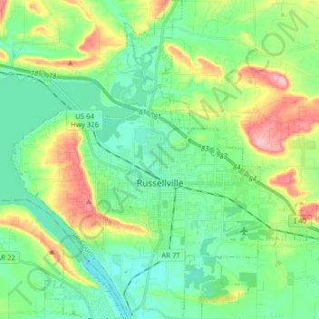
Name: Russellville topographic map, elevation, terrain.

Location: Russellville, Pope County, Arkansas, United States (35.22398 -93.20698 35.35133 -93.06183)

Average elevation: 436 ft

Minimum elevation: 279 ft

Maximum elevation: 807 ft

Pope County trails, hiking, mountain biking, running and outdoor activities

Other topographic maps

Click on a map to view its topography, its elevation and its terrain.

Rock Springs

United States > Arkansas > Pope County

Average elevation: 715 ft

Moreland

United States > Arkansas > Pope County

Average elevation: 774 ft

Smyrna

United States > Arkansas > Pope County

Average elevation: 1,319 ft

Dover

United States > Arkansas > Pope County > Dover > Dover

The mild hills historically supported oak-hickory forest or oak-hickory-pine forest. Elevation changes and soil types make the Arkansas Valley Hills largely unsuitable for row agriculture. Instead, forest has been cleared for pastureland, poultry farming or ranching. Logging remains an important land use where…

Average elevation: 492 ft

Moreland

United States > Arkansas > Pope County > Moreland

Average elevation: 774 ft

Gear up for your next adventure:

👖Convertible Hiking Pants - Versatile zip-off pants for changing altitudes and temperatures
🛡️Insect Repellent - Protection against bugs during outdoor activities
🔪Outdoor Multitools - Essential survival tools for gear repair and field use
📦Gear Storage Bags - Organize and protect outdoor equipment
🔌Solar Panel Charger - Charge gear sustainably outdoors

As an Amazon Associate, this site earns from qualifying purchases at no extra cost to you.