Geolocate

Keperra topographic map

Click on the map to display elevation.

About this map

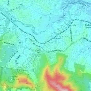
Name: Keperra topographic map, elevation, terrain.

Location: Keperra, City of Brisbane, Queensland, 4054, Australia (-27.42833 152.93428 -27.39686 152.96730)

Average elevation: 279 ft

Minimum elevation: 128 ft

Maximum elevation: 856 ft

Other topographic maps

Click on a map to view its topography, its elevation and its terrain.

Enoggera Hill

Australia > Queensland > City of Brisbane

Average elevation: 374 ft

Toohey Mountain

Australia > Queensland > City of Brisbane

Average elevation: 174 ft

Blunder Creek

Australia > Queensland > City of Brisbane

Average elevation: 85 ft

Tangalooma

Australia > Queensland > City of Brisbane

Average elevation: 135 ft

Timberland Park

Australia > Queensland > City of Brisbane

Average elevation: 121 ft

Deepwater Bend

Australia > Queensland > City of Brisbane

Average elevation: 16 ft

Tangalooma

Australia > Queensland > City of Brisbane

Average elevation: 135 ft

Gear up for your next adventure:

📡GPS Antenna Upgrade - Enhance GPS reception in remote terrain
🥘Titanium Cookware - Durable, featherlight pots and pans for backpacking
🛏️Cold Weather Sleeping Bag - Warm sleeping bag for cold conditions
🔊Portable Camp Speaker - Music and alerts at camp
📚USA Hiking Guide Books - Top trail guides and map books

As an Amazon Associate, this site earns from qualifying purchases at no extra cost to you.