
O-Pipon-Na-Piwin Cree Nation topographic map
Interactive map
Click on the map to display elevation.
About this map
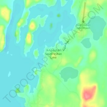
Name: O-Pipon-Na-Piwin Cree Nation topographic map, elevation, terrain.
Location: O-Pipon-Na-Piwin Cree Nation, Manitoba, Canada (56.75907 -98.94777 56.79907 -98.90777)
Average elevation: 883 ft
Minimum elevation: 830 ft
Maximum elevation: 1,053 ft
Other topographic maps
Click on a map to view its topography, its elevation and its terrain.
Southern Indian Lake
Canada > Manitoba > O-Pipon-Na-Piwin Cree Nation
Southern Indian Lake, Anderson Road, O-Pipon-Na-Piwin Cree Nation, Manitoba, Canada
Average elevation: 965 ft