
Municipalità 3 topographic map
Interactive map
Click on the map to display elevation.
About this map
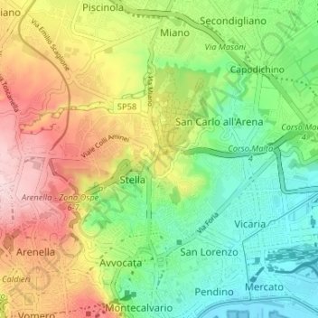
Name: Municipalità 3 topographic map, elevation, terrain.
Location: Municipalità 3, Napoli, NA, CAM, Italia (40.85285 14.22012 40.88325 14.28497)
Average elevation: 384 ft
Minimum elevation: 0 ft
Maximum elevation: 938 ft
Other topographic maps
Click on a map to view its topography, its elevation and its terrain.
Isola la Gaiola
Isola la Gaiola, Napoli, NA, CAM, Italia
Average elevation: 62 ft