
Municipalità 4 topographic map
Interactive map
Click on the map to display elevation.
About this map
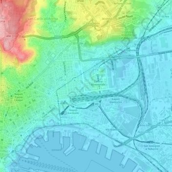
Name: Municipalità 4 topographic map, elevation, terrain.
Location: Municipalità 4, Napoli, NA, CAM, Italia (40.83583 14.24974 40.87692 14.30854)
Average elevation: 108 ft
Minimum elevation: -26 ft
Maximum elevation: 528 ft
Other topographic maps
Click on a map to view its topography, its elevation and its terrain.
Isola la Gaiola
Isola la Gaiola, Napoli, NA, CAM, Italia
Average elevation: 62 ft