Geolocate

Kamm topographic map

Click on the map to display elevation.

About this map

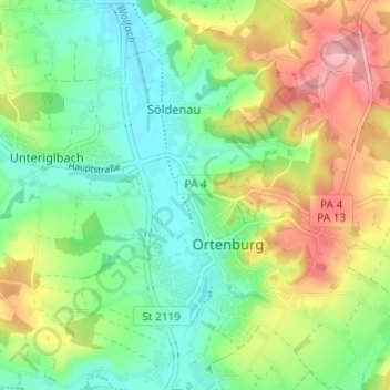
Name: Kamm topographic map, elevation, terrain.

Location: Kamm, Söldenau, Ortenburg, Landkreis Passau, Bayern, 94496, Deutschland (48.53177 13.20103 48.57177 13.24103)

Average elevation: 1,257 ft

Minimum elevation: 1,096 ft

Maximum elevation: 1,522 ft

Other topographic maps

Click on a map to view its topography, its elevation and its terrain.

Gear up for your next adventure:

🗺️Topographic Maps - Detailed topo maps for hiking, exploring and outdoor navigation
🔋Solar Power Banks - Keep your GPS and phone charged in remote wilderness areas
🥘Titanium Cookware - Durable, featherlight pots and pans for backpacking
🧭Map Reading Tools - Tools and kits for map navigation
🧺Microfiber Travel Towels - Compact and fast-drying towels for trail use

As an Amazon Associate, this site earns from qualifying purchases at no extra cost to you.