Geolocate

Incari topographic map

Click on the map to display elevation.

About this map

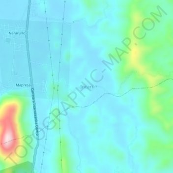
Name: Incari topographic map, elevation, terrain.

Location: Incari, Provincia de Leoncio Prado, Huánuco, Perú (-9.28207 -75.99736 -9.24207 -75.95736)

Average elevation: 2,234 ft

Minimum elevation: 2,047 ft

Maximum elevation: 3,235 ft

Gear up for your next adventure:

📡GPS Antenna Upgrade - Enhance GPS reception in remote terrain
🔥Plasma Lighters - Windproof lighters that work in any weather condition
🗺️NatGeo Topo Maps - High-quality waterproof printed topographic maps of US Parks
Backpacking Tents - Weight-optimized shelters for multi-day topographic surveys
🪑Portable Camp Table - Compact table for campsite meals

As an Amazon Associate, this site earns from qualifying purchases at no extra cost to you.