
Thank you for supporting this site ❤️
Make a donation
Make a donation
Gear up for your next adventure:
As an Amazon Associate, this site earns from qualifying purchases at no extra cost to you.
Tyndrum topographic map
Click on the map to display elevation.
Thank you for supporting this site ❤️
Make a donation
Make a donation
Gear up for your next adventure:
As an Amazon Associate, this site earns from qualifying purchases at no extra cost to you.
About this map
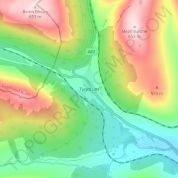
Name: Tyndrum topographic map, elevation, terrain.
Location: Tyndrum, Stirling, Scotland, FK20, United Kingdom (56.41591 -4.73169 56.45591 -4.69169)
Average elevation: 1,175 ft
Minimum elevation: 558 ft
Maximum elevation: 2,133 ft
Thank you for supporting this site ❤️
Make a donation
Make a donation
Gear up for your next adventure:
As an Amazon Associate, this site earns from qualifying purchases at no extra cost to you.