
Thank you for supporting this site ❤️
Make a donation
Make a donation
Gear up for your next adventure:
As an Amazon Associate, this site earns from qualifying purchases at no extra cost to you.
Beba topographic map
Click on the map to display elevation.
Thank you for supporting this site ❤️
Make a donation
Make a donation
Gear up for your next adventure:
As an Amazon Associate, this site earns from qualifying purchases at no extra cost to you.
About this map
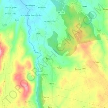
Name: Beba topographic map, elevation, terrain.
Location: Beba, Mazaricos, O Xallas, A Coruña, Galicia, 15258, Spain (42.89377 -9.01735 42.93767 -8.97282)
Average elevation: 1,099 ft
Minimum elevation: 850 ft
Maximum elevation: 1,453 ft
Thank you for supporting this site ❤️
Make a donation
Make a donation
Gear up for your next adventure:
As an Amazon Associate, this site earns from qualifying purchases at no extra cost to you.