
Make a donation
Gear up for your next adventure:
As an Amazon Associate, this site earns from qualifying purchases at no extra cost to you.
Mooreland topographic map
Click on the map to display elevation.
Make a donation
Gear up for your next adventure:
As an Amazon Associate, this site earns from qualifying purchases at no extra cost to you.
Mooreland
Mooreland is a town in Woodward County, Oklahoma, United States, 10 miles (16 km) east of the city of Woodward, the county seat. The population was 1,190 at the 2010 census. Mooreland lies in a valley approximately 5 miles (8.0 km) north of the North Canadian River. This area of shallow-water land lies at an altitude of 1,900 feet (580 m).
Make a donation
Gear up for your next adventure:
As an Amazon Associate, this site earns from qualifying purchases at no extra cost to you.
About this map
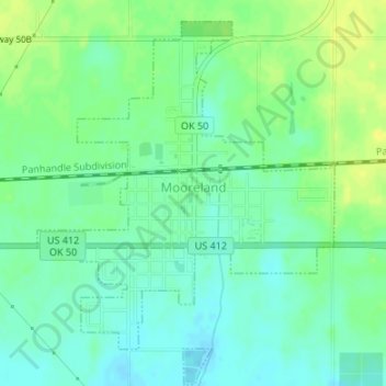
Name: Mooreland topographic map, elevation, terrain.
Location: Mooreland, Woodward County, Oklahoma, 73852, United States (36.42536 -99.21842 36.45078 -99.19254)
Average elevation: 1,903 ft
Minimum elevation: 1,873 ft
Maximum elevation: 1,939 ft
Woodward County trails, hiking, mountain biking, running and outdoor activities
Make a donation
Gear up for your next adventure:
As an Amazon Associate, this site earns from qualifying purchases at no extra cost to you.
Other topographic maps
Click on a map to view its topography, its elevation and its terrain.