
Thank you for supporting this site ❤️
Make a donation
Make a donation
Gear up for your next adventure:
As an Amazon Associate, this site earns from qualifying purchases at no extra cost to you.
Sestrières topographic map
Click on the map to display elevation.
Thank you for supporting this site ❤️
Make a donation
Make a donation
Gear up for your next adventure:
As an Amazon Associate, this site earns from qualifying purchases at no extra cost to you.
About this map
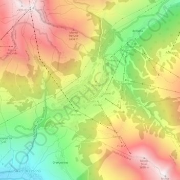
Name: Sestrières topographic map, elevation, terrain.
Location: Sestrières, Turin, Piémont, 10058, Italie (44.93845 6.85869 44.97845 6.89869)
Average elevation: 6,955 ft
Minimum elevation: 4,928 ft
Maximum elevation: 8,868 ft
Thank you for supporting this site ❤️
Make a donation
Make a donation
Gear up for your next adventure:
As an Amazon Associate, this site earns from qualifying purchases at no extra cost to you.