
Thank you for supporting this site ❤️
Make a donation
Make a donation
Gear up for your next adventure:
As an Amazon Associate, this site earns from qualifying purchases at no extra cost to you.
Mount Uling topographic map
Click on the map to display elevation.
Thank you for supporting this site ❤️
Make a donation
Make a donation
Gear up for your next adventure:
As an Amazon Associate, this site earns from qualifying purchases at no extra cost to you.
About this map
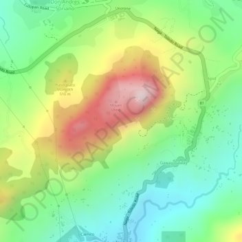
Name: Mount Uling topographic map, elevation, terrain.
Location: Mount Uling, Naga, Cebu, Central Visayas, Philippines (10.29467 123.71245 10.29477 123.71255)
Average elevation: 1,093 ft
Minimum elevation: 443 ft
Maximum elevation: 2,011 ft
Thank you for supporting this site ❤️
Make a donation
Make a donation
Gear up for your next adventure:
As an Amazon Associate, this site earns from qualifying purchases at no extra cost to you.