Geolocate

Imbariz topographic map

Click on the map to display elevation.

About this map

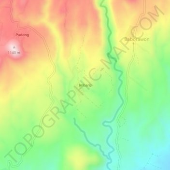
Name: Imbariz topographic map, elevation, terrain.

Location: Imbariz, Malinao, Bukidnon, Northern Mindanao, Philippines (7.79910 124.70064 7.83910 124.74064)

Average elevation: 2,927 ft

Minimum elevation: 2,231 ft

Maximum elevation: 3,760 ft

Gear up for your next adventure:

🎒Hydration Pack - Hands‑free water reservoir for long hikes
🏔️Mountain Trail Maps - High‑detail maps for popular peaks
Camping Coffee Makers - Enjoy premium coffee at the summit or campsite
🚗GPS Dash Cams - Record your scenic drives through mountain passes and canyons
👓Polarized Sunglasses - Outdoor sunglasses for glare reduction

As an Amazon Associate, this site earns from qualifying purchases at no extra cost to you.