
Thank you for supporting this site ❤️
Make a donation
Make a donation
Gear up for your next adventure:
As an Amazon Associate, this site earns from qualifying purchases at no extra cost to you.
Martín topographic map
Click on the map to display elevation.
Thank you for supporting this site ❤️
Make a donation
Make a donation
Gear up for your next adventure:
As an Amazon Associate, this site earns from qualifying purchases at no extra cost to you.
About this map
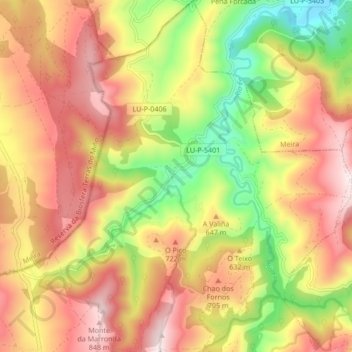
Name: Martín topographic map, elevation, terrain.
Location: Martín, Baleira, A Fonsagrada, Lugo, Galicia, 27276, Spain (43.09713 -7.26857 43.15900 -7.19641)
Average elevation: 1,942 ft
Minimum elevation: 827 ft
Maximum elevation: 2,900 ft
Thank you for supporting this site ❤️
Make a donation
Make a donation
Gear up for your next adventure:
As an Amazon Associate, this site earns from qualifying purchases at no extra cost to you.