Geolocate

Middelharnis topographic map

Click on the map to display elevation.

About this map

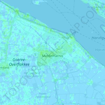
Name: Middelharnis topographic map, elevation, terrain.

Location: Middelharnis, Goeree-Overflakkee, South Holland, Netherlands (51.71793 4.14390 51.80238 4.26727)

Average elevation: 0 ft

Minimum elevation: -10 ft

Maximum elevation: 23 ft

Gear up for your next adventure:

🪶Multi‑Purpose Knife - Useful blade for camp and trail
👖Convertible Hiking Pants - Versatile zip-off pants for changing altitudes and temperatures
📚USA Hiking Guide Books - Top trail guides and map books
❄️Traction Cleats - Prevent slips on icy trails during winter hikes
📡Handheld GPS Device - Reliable handheld GPS for outdoor navigation

As an Amazon Associate, this site earns from qualifying purchases at no extra cost to you.