
Teague topographic map
Interactive map
Click on the map to display elevation.
About this map
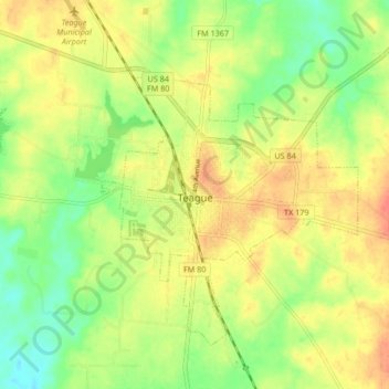
Name: Teague topographic map, elevation, terrain.
Location: Teague, Freestone County, Texas, 75860, United States (31.59999 -96.33258 31.65524 -96.24884)
Average elevation: 479 ft
Minimum elevation: 397 ft
Maximum elevation: 554 ft
Other topographic maps
Click on a map to view its topography, its elevation and its terrain.
Wortham
United States > Texas > Freestone County
Wortham, Freestone County, Texas, United States
Average elevation: 466 ft
Lake Port
United States > Texas > Freestone County
Lake Port, Freestone County, Texas, United States
Average elevation: 269 ft
Little Red Lake
United States > Texas > Freestone County
Little Red Lake, Freestone County, Texas, United States
Average elevation: 387 ft
Streetman
United States > Texas > Freestone County
Streetman, Freestone County, Texas, United States
Average elevation: 371 ft
Fairfield
United States > Texas > Freestone County
Fairfield, Freestone County, Texas, 75840, United States
Average elevation: 453 ft