Geolocate

Streetman topographic map

Click on the map to display elevation.

About this map

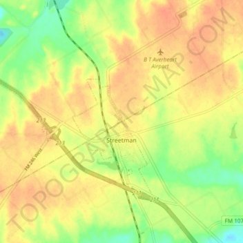
Name: Streetman topographic map, elevation, terrain.

Location: Streetman, Freestone County, Texas, United States (31.85893 -96.38349 31.90505 -96.30889)

Average elevation: 371 ft

Minimum elevation: 289 ft

Maximum elevation: 423 ft

Freestone County trails, hiking, mountain biking, running and outdoor activities

Other topographic maps

Click on a map to view its topography, its elevation and its terrain.

Little Red Lake

United States > Texas > Freestone County

Average elevation: 387 ft

Lake Port

United States > Texas > Freestone County

Average elevation: 269 ft

Gear up for your next adventure:

🥾Women's Hiking Boots - Top-rated trail boots with ankle support and superior grip
🌡️Handheld Weather Meters - Measure wind, temp, and pressure for safe mountain travel
🔊Portable Camp Speaker - Music and alerts at camp
📦Gear Storage Bags - Organize and protect outdoor equipment
🪶Compact Camp Shovel - Folding shovel for campsite tasks

As an Amazon Associate, this site earns from qualifying purchases at no extra cost to you.