

Tiruchirappalli topographic map
Click on the map to display elevation.
Tiruchirappalli
Tiruchirappalli is situated in central south-eastern India, almost at the geographic centre of the state of Tamil Nadu. The Cauvery Delta begins to form 16 kilometres (9.9 mi) west of the city where the river divides into two streams—the Kaveri and the Kollidam—to form the island of Srirangam. By road it is 912 kilometres (567 mi) south of Hyderabad, 322 kilometres (200 mi) south-west of Chennai and 331 kilometres (206 mi) south-east of Bangalore. The topology of Tiruchirappalli is almost flat with an average elevation of 88 metres (289 ft). A few isolated hillocks rise above the surface, the highest of which is the Rockfort; its estimated age of 3,800 million years makes it one of the oldest rocks in the world. Other prominent hillocks include the Golden Rock, Khajamalai, and one each at Uyyakondan Thirumalai and Thiruverumbur.
About this map
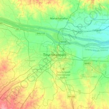
Name: Tiruchirappalli topographic map, elevation, terrain.
Average elevation: 272 ft
Minimum elevation: 177 ft
Maximum elevation: 456 ft