
Virginia Beach topographic map
Click on the map to display elevation.
Virginia Beach
Virginia Beach, Virginia, located in the coastal region of the United States, features a predominantly flat terrain characterized by its proximity to the Atlantic Ocean. The elevation is remarkably low, averaging about 10 feet (3 meters) above sea level, which contributes to the area's susceptibility to flooding, particularly during storm surges. The landscape is defined by its sandy beaches, marshlands, and tidal estuaries, creating a unique coastal ecosystem. Additionally, inland areas are interspersed with forests and wetlands, providing habitat for diverse wildlife. The city's geography plays a vital role in its recreational opportunities, from beach activities to water sports, attracting millions of visitors annually.
About this map
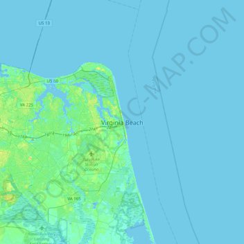
Name: Virginia Beach topographic map, elevation, terrain.
Location: Virginia Beach, Virginia, 23451, United States (36.69298 -76.13742 37.01298 -75.81742)
Average elevation: 7 ft
Minimum elevation: -39 ft
Maximum elevation: 56 ft
Virginia trails, hiking, mountain biking, running and outdoor activities
Other topographic maps
Click on a map to view its topography, its elevation and its terrain.