
Yang-Tsé topographic map
Interactive map
Click on the map to display elevation.
About this map
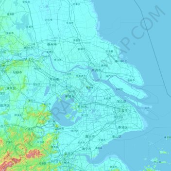
Name: Yang-Tsé topographic map, elevation, terrain.
Location: Yang-Tsé, 张家港市 (Zhangjiagang), 苏州市, Jiangsu, 210003, RPC (31.05330 118.50573 32.32435 122.24235)
Average elevation: 95 ft
Minimum elevation: -10 ft
Maximum elevation: 5,686 ft
Other topographic maps
Click on a map to view its topography, its elevation and its terrain.