
Meidob Volcanic Field topographic map
Interactive map
Click on the map to display elevation.
About this map
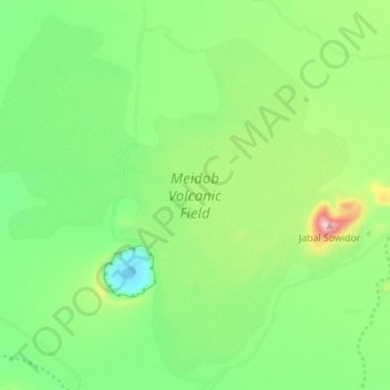
Name: Meidob Volcanic Field topographic map, elevation, terrain.
Location: Meidob Volcanic Field, Nord-Darfur, Sudan (15.11372 26.14427 15.17494 26.21300)
Average elevation: 2,917 ft
Minimum elevation: 2,575 ft
Maximum elevation: 3,606 ft
Other topographic maps
Click on a map to view its topography, its elevation and its terrain.
Al ‘Aţrūn
Sudan > Nord-Darfur > Mellit
Al ‘Aţrūn, Mellit, Nord-Darfur, Sudan
Average elevation: 1,686 ft
Al-Faschir
Sudan > Nord-Darfur > Al Fasher
Al-Faschir, Al Fasher, Nord-Darfur, Sudan
Average elevation: 2,470 ft