Geolocate

Wohlen topographic map

Click on the map to display elevation.

About this map
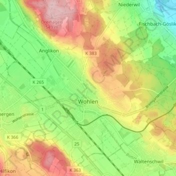
Name: Wohlen topographic map, elevation, terrain.

Location: Wohlen, Bezirk Bremgarten, Aargau, Switzerland (47.33376 8.25038 47.37437 8.31941)

Average elevation: 1,460 ft

Minimum elevation: 1,161 ft

Maximum elevation: 1,801 ft

Other topographic maps

Click on a map to view its topography, its elevation and its terrain.

Hilfikon

Switzerland > Aargau > Bezirk Bremgarten

Average elevation: 1,749 ft

Gear up for your next adventure:

🕶️Glacier Sunglasses - Side shields to protect eyes from high-altitude snow glare
🌲Outdoor Survival Books - Best books on survival skills
🖼️Topo Map Wall Art - Decorative topographic prints of famous peaks and regions
📱Solar Portable Charger - Solar power bank for charging devices off‑grid
🎒Hydration Pack - Hands‑free water reservoir for long hikes

As an Amazon Associate, this site earns from qualifying purchases at no extra cost to you.