Geolocate

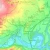
Rossett topographic map

Click on the map to display elevation.

About this map

Name: Rossett topographic map, elevation, terrain.

Location: Rossett, Wrexham, Wales, LL12 0DE, United Kingdom (53.08962 -2.96491 53.12962 -2.92491)

Average elevation: 66 ft

Minimum elevation: 13 ft

Maximum elevation: 256 ft

Other topographic maps

Click on a map to view its topography, its elevation and its terrain.
Bangor-on-Dee

United Kingdom > Wales > Wrexham

Average elevation: 98 ft

Cefn

United Kingdom > Wales > Wrexham > Acrefair

Average elevation: 466 ft

Gwersyllt

United Kingdom > Wales > Wrexham

Average elevation: 367 ft

Penycae

United Kingdom > Wales > Wrexham

Average elevation: 1,148 ft

Rhosddu

United Kingdom > Wales > Wrexham

Average elevation: 289 ft

Ceiriog Ucha

United Kingdom > Wales > Wrexham

Average elevation: 1,378 ft

Gear up for your next adventure:

🌧️Backpack Rain Cover - Keep gear dry in wet weather
🔋Rechargeable Batteries - Power up your outdoor devices
📚USA Hiking Guide Books - Top trail guides and map books
🧺Microfiber Travel Towels - Compact and fast-drying towels for trail use
🔦Compact Flashlight - Reliable flashlight for emergencies

As an Amazon Associate, this site earns from qualifying purchases at no extra cost to you.