
Granville Lake topographic map
Interactive map
Click on the map to display elevation.
About this map
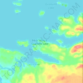
Name: Granville Lake topographic map, elevation, terrain.
Location: Granville Lake, Manitoba, Canada (56.19188 -100.61095 56.27188 -100.53095)
Average elevation: 889 ft
Minimum elevation: 843 ft
Maximum elevation: 1,086 ft
Other topographic maps
Click on a map to view its topography, its elevation and its terrain.
Granville Lake
Canada > Manitoba > Granville Lake
Granville Lake, Manitoba, Canada
Average elevation: 876 ft