
Nast topographic map
Interactive map
Click on the map to display elevation.
About this map
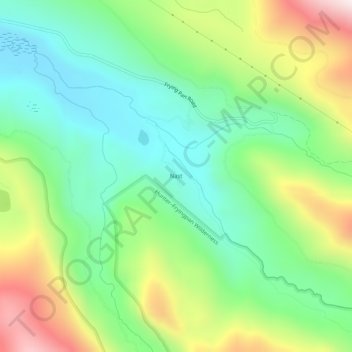
Name: Nast topographic map, elevation, terrain.
Location: Nast, Pitkin County, Colorado, USA (39.27165 -106.62142 39.31165 -106.58142)
Average elevation: 9,524 ft
Minimum elevation: 8,606 ft
Maximum elevation: 11,227 ft
Other topographic maps
Click on a map to view its topography, its elevation and its terrain.
Hunter–Fryingpan Wilderness Area
Hunter–Fryingpan Wilderness Area, Chapman Gulch, Nast, Pitkin County, Colorado, USA
Average elevation: 11,175 ft