Geolocate

Maasbree topographic map

Click on the map to display elevation.

About this map

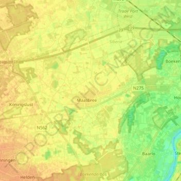
Name: Maasbree topographic map, elevation, terrain.

Location: Maasbree, Peel en Maas, Limburg, Netherlands (51.33114 5.95790 51.39573 6.10189)

Average elevation: 95 ft

Minimum elevation: 36 ft

Maximum elevation: 125 ft

Gear up for your next adventure:

⛑️Personal Locator Beacon - Safety beacon for emergencies
🧭Outdoor Navigation Book - Learn advanced navigation skills
Backpacking Tent - Lightweight and durable tent for multi‑day hikes
🧦Hiking Socks - Comfortable socks to prevent blisters on long hikes
🪶Camp Gear Gift Set - Perfect gift bundle for outdoor fans

As an Amazon Associate, this site earns from qualifying purchases at no extra cost to you.